
The Great Highland Water-Thaw: The 18-Fall Circular Circuit
Sri Lanka has 400+ waterfalls, but most miss the best. Based on 130+ treks, this logbook breaks down the ultimate 18-fall circuit from Kandy to Hatton. Join our community to unlock the exclusive Google Map with all 18 GPS pins at the end of this article!

The Explorer's Logic: Sri Lanka is one of the most waterfall-dense nations on earth, with over 400 identified cascades etched into its tropical spine. But quantity doesn't always mean quality. Many are mere seasonal trickles or victims of human diversion. Having explored 130+ falls, I’ve curated this specific "Circular Circuit" to target the heavy hitters like Bomuru Ella, St. Clair’s, and Devon.
This is a tactical road trip. While public transport exists, it is a massive time-sink for a project of this scale. To cover the most ground, use a motorbike, Tuk-Tuk, or private vehicle. Timing is everything: you want the "Sweet Spot"—a few days after the heavy rains. Visit during the peak monsoon and the water is a brown, muddy mess; visit in the deep dry season and the "silky" veins you see in photos turn into bone-dry rock.
| Attribute | Details |
| 📍 Location | Kandy, Nuwara Eliya, and Hatton Districts (Central Highlands) |
| ⏰ Optimal Window | 2 days post-rain |
| 🏔️ Difficulty | Level 2 Most of them are road side. |
| 👨👩👧👦 Family Note | Roadside falls (St. Clair's, Devon) are effortless; Phase 2 & 3 require hiking endurance. |
| 🚜 Access Mode | Motorbike or Tuk-Tuk for maximum agility on estate backroads. |
Historical Field Notes:
The waterfalls of the central highlands are geological "step-downs" of the three Precambrian peneplains. These falls are literally the overflow of a 2-billion-year-old plateau grinding against the changing tropical climate.
Phase 1: The Mainline Ascent (Kandy to Nuwara Eliya)
Helboda Falls
The air starts to lose its tropical weight here, replaced by the scent of crushed tea leaves and wet asphalt. This is a tiered roadside cascade where the water hits the lower pool with a bright, metallic splash. In the dry season, it’s a forgettable trickle, but after a heavy highland downpour, it transforms into a percussive refresh for weary travelers, spraying the road with a fine, cold mist.
- Type: Tiered Roadside Cascade
- Explorer Rating: ⭐ (Perfect for a quick "refresh" stop; only worth it in the rainy season)
- Time Spent: 15 minutes.
Delta Falls (Pussellawa)
A 60-meter vertical streak that cuts a sharp white line through the dense canopy. The sound is a constant, high-frequency hiss. In heavy rain, the valley wind catches the bottom of the fall, turning it into a fine, swirling vapor.
- Type: Narrow Plunge
- Explorer Rating: ⭐ (Impressive height, but can be thin in dry weather)
- Time Spent: 10 minutes.
Puna Oya Falls
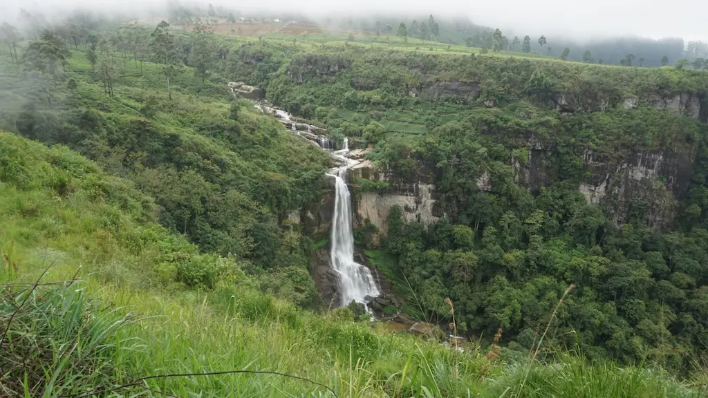
A rare "Twin Fall" appearing as a silver V-shape etched into the mountain. From the road, it looks motionless—a static white ribbon draped over the emerald tea bushes. During the dry months, the "twins" often become so skeletal that the distance makes them look like mere damp streaks on the cliffside, losing all visual appeal. Even when it isn't the peak dry season, the water flow might be low, making it a "ghost fall" that requires high-volume rain to truly activate its dual streams. To feel its power, you must commit to the hike to reach the base, where the environment is dominated by intense forest humidity and the deep, vibrating thud of water hitting a boulder-strewn basin.
- Type: Twin Vertical Drop
- Explorer Rating: ⭐⭐⭐⭐ (A tactical win after rain)
- Best Photo Spot: The Ramboda observation deck (Tea Bush Ramboda Hotel) for a compressed long-lens shot of the twin streams.
- Time Spent: 15 minutes on the observation deck; 2+ hours if trekking.
- The Access Note: The hike to the base is a serious undertaking. The trail is completely unmarked and easily lost to the undergrowth. You must ask for directions from locals in the immediate area to ensure you don't wander off-track into the thick jungle.
Devatura Falls
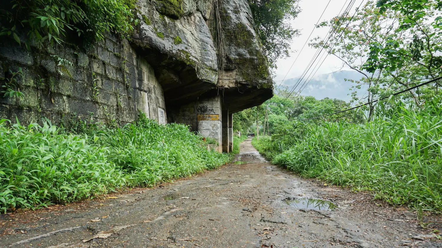
A chaotic, fall that bounces off granite ledges before diving under the A5 highway. The atmosphere here is defined by the sharp, metallic smell of wet rock and the roar of traffic echoed by the stone. You can see the old colonial bypass road , now reclaimed by thick, neon-green moss and ferns. This old road sits to the right of the new tunnel; you can actually walk along this historical stretch to reach the other side, giving you a rare, immersive view of the water without the barrier of modern guardrails.
- Type: Roadside Waterfall
- Explorer Rating: ⭐⭐⭐ (Great for texture and architectural contrast)
- Best Photo Spot: Just before the tunnel entrance
- Time Spent: 20 minutes.
Ramboda Lower Falls
A secluded basin fall that feels world's away from the highway. The water settles here into a wide, deep pool where the distant roar of the upper tiers is muffled by the thick vegetation.
- Type: Basin Cascade
- Explorer Rating: ⭐⭐⭐ ⭐⭐(Peaceful and great for tripod work)
- Best Photo Spot: The lower observation deck of the Ramboda Falls Hotel for a level-horizon shot.
- Time Spent: 1 hour.
Ramboda Upper Falls
The "Heavyweight." A massive 109-meter drop that creates its own wind system at the base. The roar is a low-frequency thrum that vibrates in your chest. The surrounding rock is stained black by centuries of relentless moisture.
- Type: High-Volume Plunge
- Explorer Rating: ⭐⭐⭐⭐⭐ (The hero of the A5 pass)
- Best Photo Spot: The wet rocks at the end of the paved path. Use a slow shutter speed (0.5s) for a silky, misty effect.
- Time Spent: 45 minutes.
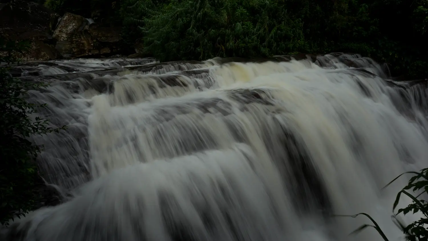
Ramboda Middle Falls
A wide, utilitarian segment flowing directly under the main road bridge. It is characterized by a steady, even flow across broad stone steps, creating a constant white-water "fizz."
- Type: Wide Segmented Fall
- Explorer Rating: ⭐⭐ (Iconic, but usually overcrowded)
- Best Photo Spot: From the center of the road bridge, looking directly down into the bubbling stream.
- Time Spent: 5 minutes.
Phase 2: The High-Altitude Interior (Nuwara Eliya)
Lovers Leap
A delicate 30-meter ribbon of water hanging from the cliffside of Piduruthalagala. The air is cold and smells of cypress. The water often breaks into individual droplets that dance in the wind before reaching the tea estate below.
- Type: High-Altitude Ribbon
- Explorer Rating: ⭐⭐⭐ (Famous folklore, but check water levels first)
- Best Photo Spot: The flat rock platform 50 meters from the base, looking up at the sharp cliff edge.
- Time Spent: 40 minutes.
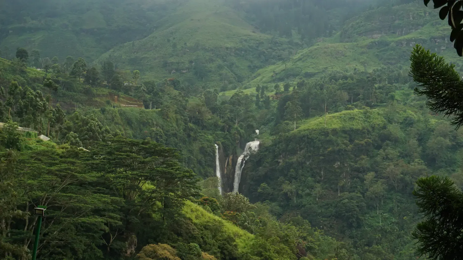
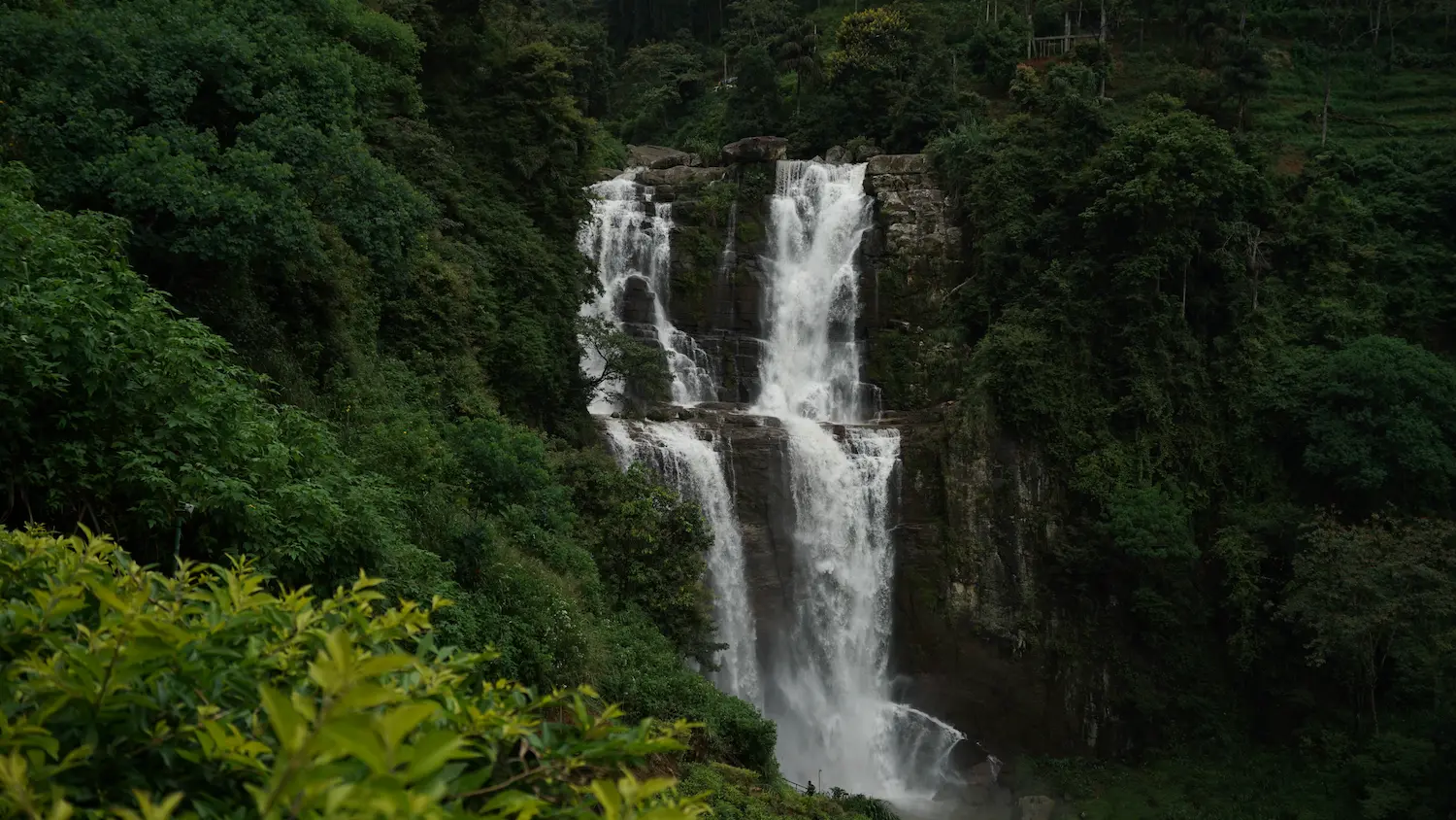
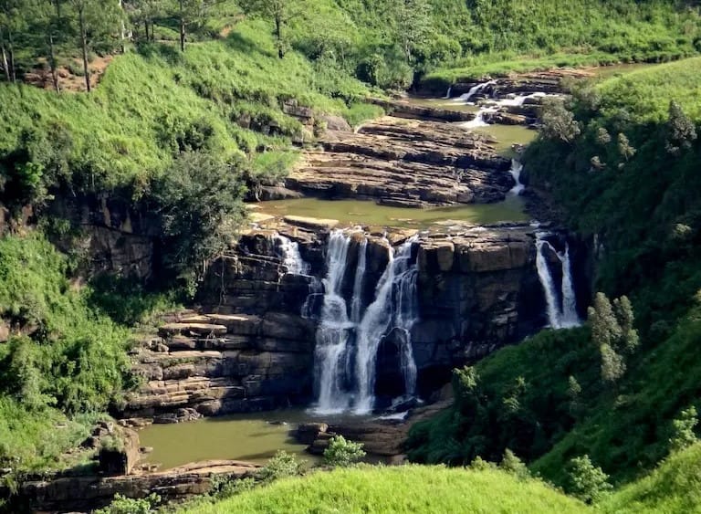
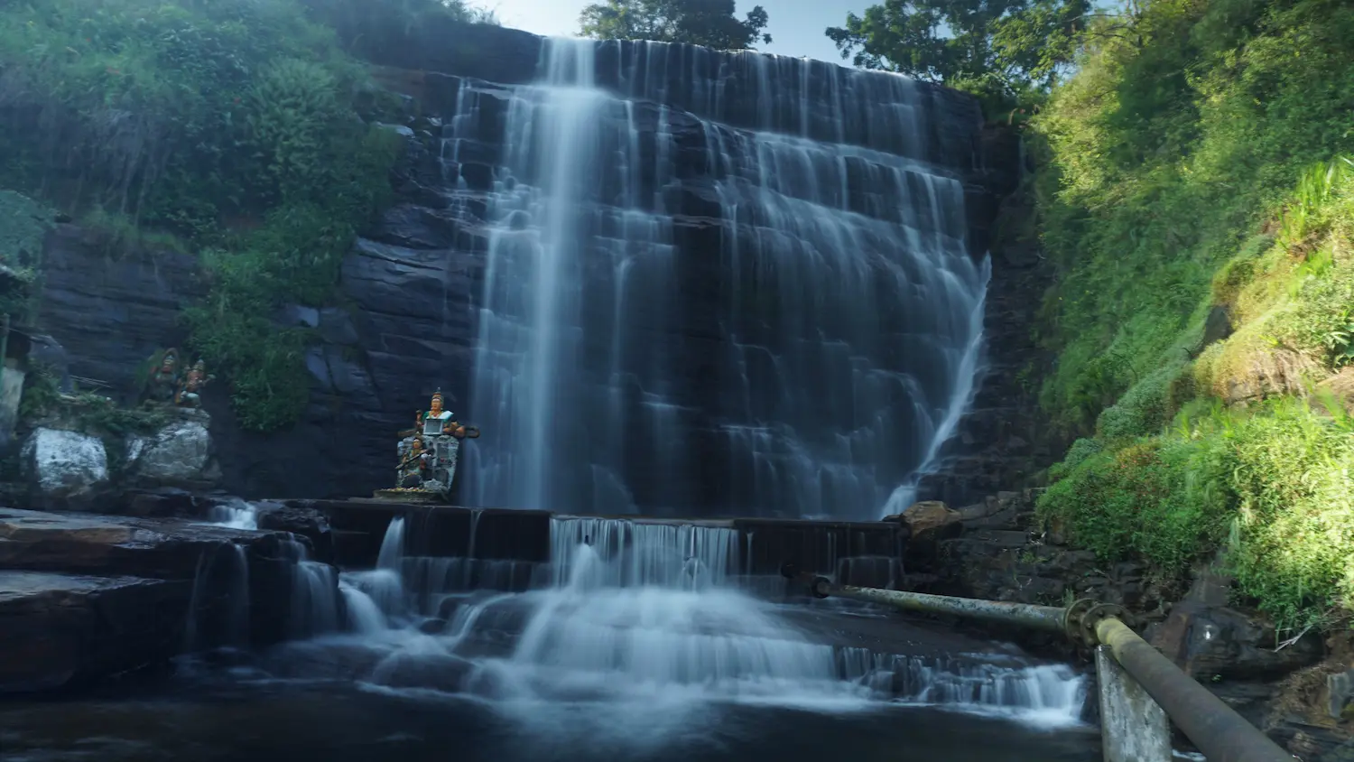
Bomuru Ella (Perawella Falls)
Arguably the most beautiful fall in Sri Lanka. It is a sprawling masterpiece that fans out across a wide, stepped rock face like intricate lace. The sound is complex—a mix of deep thuds and delicate trickling side-streams.
- Type: Wide Multi-Fall
- Explorer Rating: ⭐⭐⭐⭐⭐ (The absolute crown jewel)
- Best Photo Spot: The grassy knoll . Use an ND filter for a long exposure to get the ultimate "silk" texture.
- Time Spent: 2 hours.
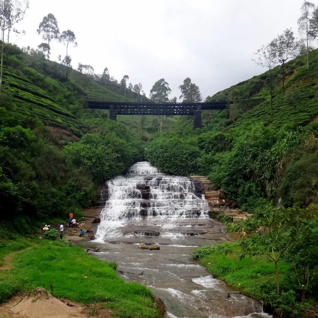
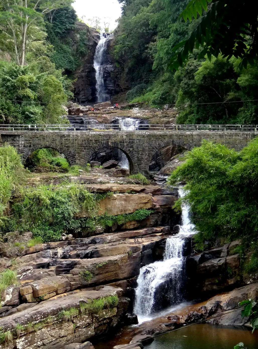
Nanu Oya Falls
A series of 25 separate steps looking like a giant’s staircase. The water is glacial-cold and turns into a blur of white as it passes under the arched Victorian railway bridge.
- Type: Tiered Rapids
- Explorer Rating: ⭐⭐⭐⭐ (Incredible scale and industrial contrast)
- Best Photo Spot: Under the railway bridge arches, framing the water cascading down the "steps."
- Time Spent: 30 minutes.
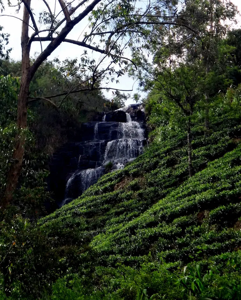
Glaso Falls (Glassaugh)
A quiet, rhythmic fall tucked deep within the tea rows. It consists of three distinct segments that slide over smooth grey slabs. The silence here is only broken by the occasional clinking of a tea picker's basket.
- Type: Estate Cascade
- Explorer Rating: ⭐⭐⭐ (An untouched, meditative stop)
- Best Photo Spot: The third railway bridge from Nanu Oya station for an elevated view.
- Time Spent: 20 minutes.
Phase 3: The Western Frontier (Talawakele & Hatton)
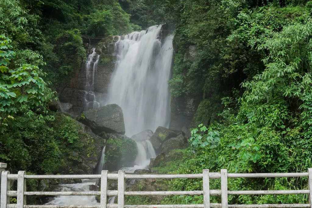
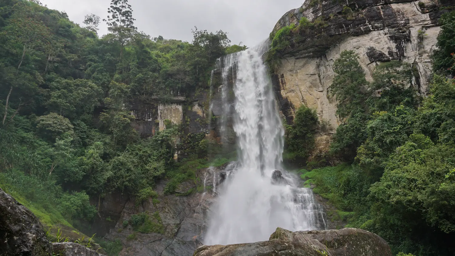
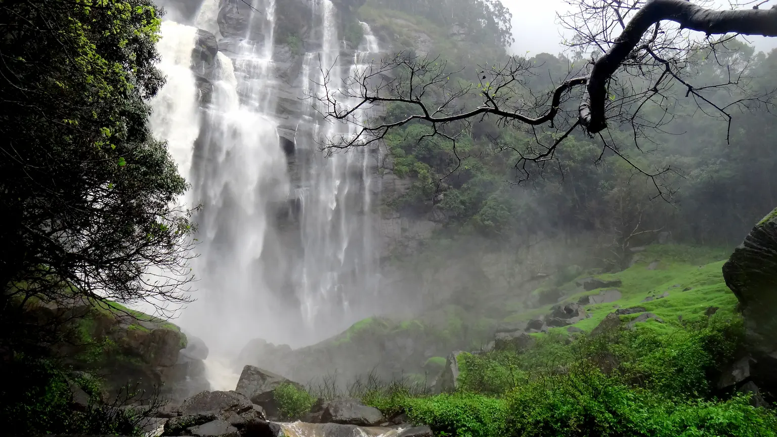
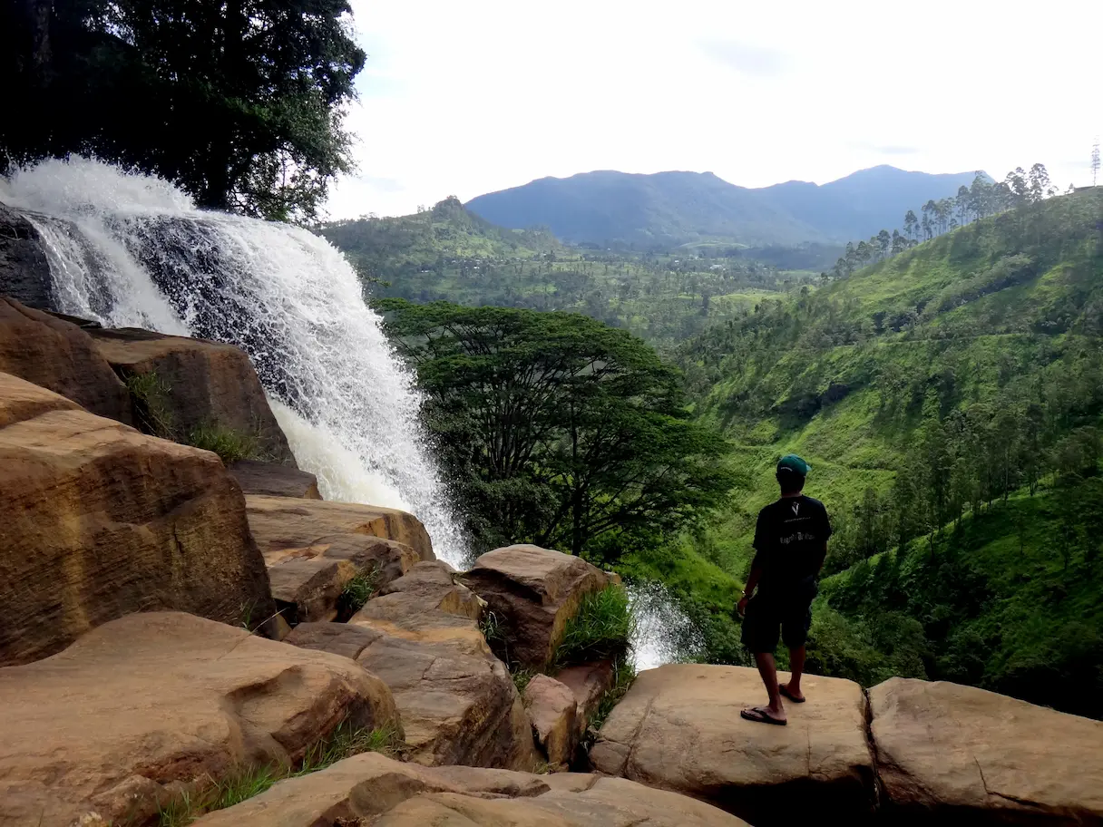
St. Clair’s Falls
The "Little Niagara." A powerhouse of horizontal volume moving in a massive, coordinated sheet over wide rock ledges. The roar is constant and the white explosion is the undisputed visual anchor of the valley.
- Type: Wide Tiered Cataract
- Explorer Rating: ⭐⭐⭐⭐⭐ (The widest and most majestic)
- Best Photo Spot: From road side observation deck
Time Spent: 30 minutes.
Pathana Falls
A slender, vertical stream dropping into a hidden forested pocket,Pathana Falls feels like a private discovery, cutting through thick vines and ferns where the air smells of wild orchids and damp mulch. This "ghostly" fall is truly a hidden gem, often completely unknown even to regular travelers of the A7 highway. To find it, you must drive approximately 750m down the narrow, winding access road leading towardThe Waterfall Villas . The waterfall itself is tucked away just under the level of the main road, making it invisible to those passing above.
- Type: Vertical Stream
- Explorer Rating: ⭐⭐⭐ (Small, intimate, and very green)
- Time Spent: 30 minutes.
Logbook Entry: This fall is best visited during or immediately after the rainy season; because of its slender nature, it can nearly vanish during the drier months. Since the road is narrow and shared with estate residents, a motorbike or Tuk-Tuk is the tactical choice for reaching the clearing without blocking the path.
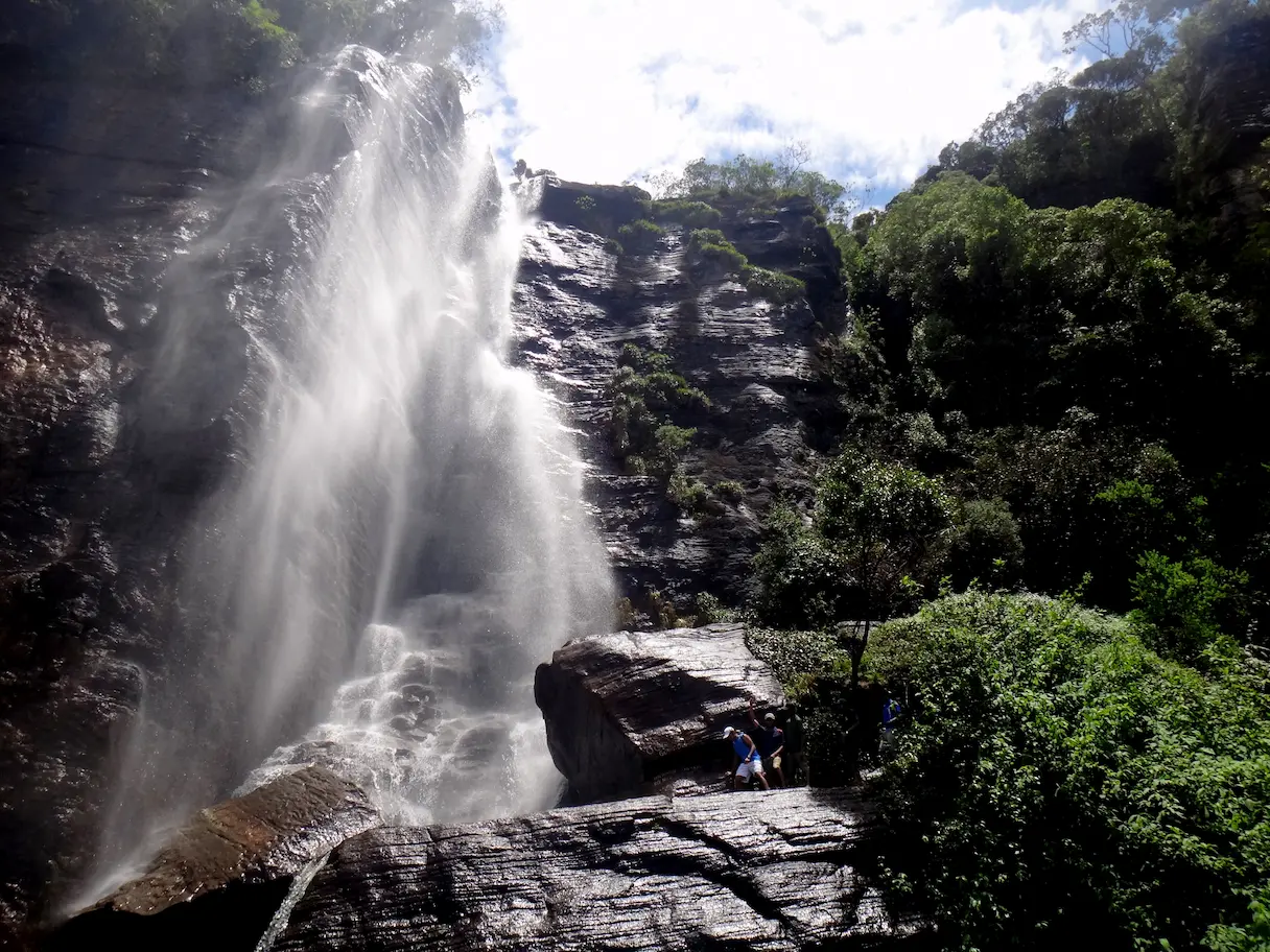
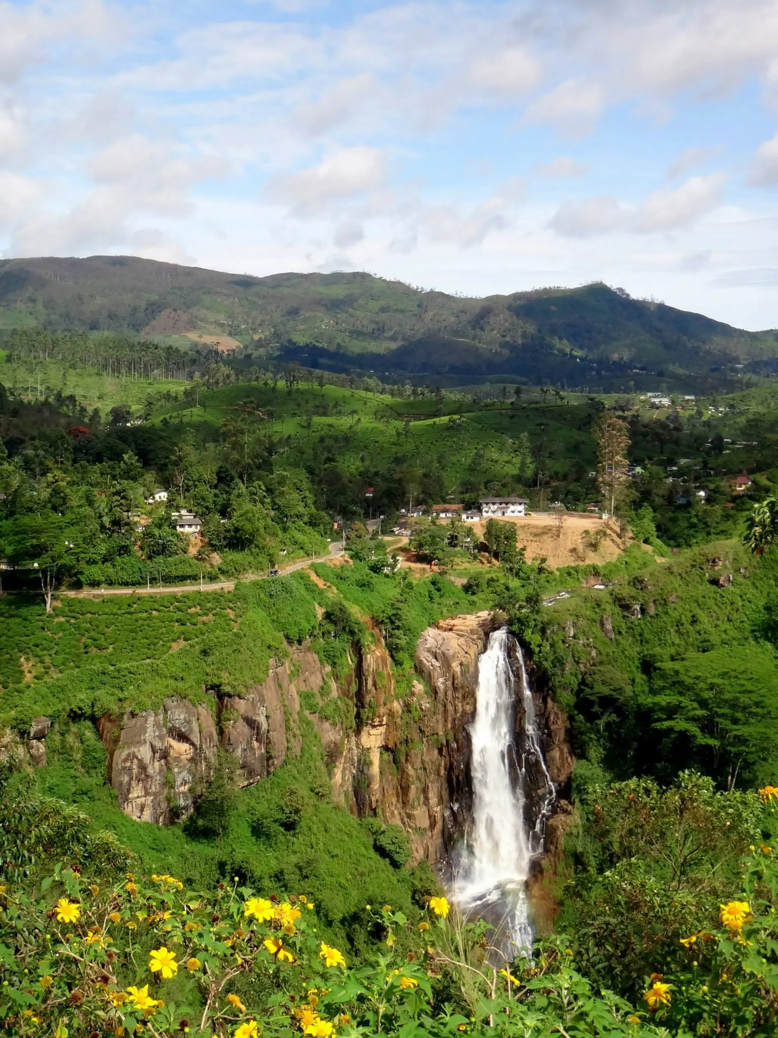
Devon Falls
A 97-meter masterpiece of symmetry and one of the most recognizable silhouettes in the highlands. The water falls in three perfect tiers, narrowing slightly at each drop like a tapering white spire. It serves as an elegant, vertical contrast to the raw, horizontal power of the nearby St. Clair's. While the distant view is classic, the true perspective is found at the lip; you can reach the top of the falls via the Dimbula road. This area is high-risk due to the sheer drop and slippery rock—you must be extremely careful and ask for specific directions from locals in the surrounding estate to find the safe access path through the tea bushes.
- Type: Tiered Plunge
- Explorer Rating: ⭐⭐⭐⭐⭐ (Perfectly proportioned for photography)
- Best Photo Spot: The Mlesna Tea Castle balcony for a classic long-range perspective, or the cliff-edge (with extreme caution) for a top-down view.
- Time Spent: 20 minutes at the viewpoint; 1 hour if navigating to the top.
- Access Tip: The turn-off from Dimbula road isn't signposted for tourists. Look for the estate workers near the junction and verify the path; the ground near the fall's "head" can be unstable after rain.
Mount Vernon Falls
A wide and gentle cascade, this waterfall flows directly past the backyards of tea estate line houses, offering a unique, human-centric atmosphere. Unlike the more isolated wilderness falls, here you’ll hear the sounds of daily life—children playing and distant radios—mingling with the steady splash of the water. It provides an authentic glimpse into the "tea country" lifestyle, where the community lives in literal harmony with the landscape.
- Type: Hidden Cascade
- Explorer Rating: ⭐⭐⭐ ⭐(A rare, lived-in perspective of the highlands)
- Time Spent: 40 minutes.
- Access Tip: This is another largely unknown spot. To find it, drive approximately 2.5km from the Dimbula junction and look for a bridge. Immediately after passing it, turn right onto the road leading toward the tea line houses. The path can be confusing as it winds through residential quarters, so you should ask for directions from the locals, who are generally friendly and will point you toward the hidden trail.
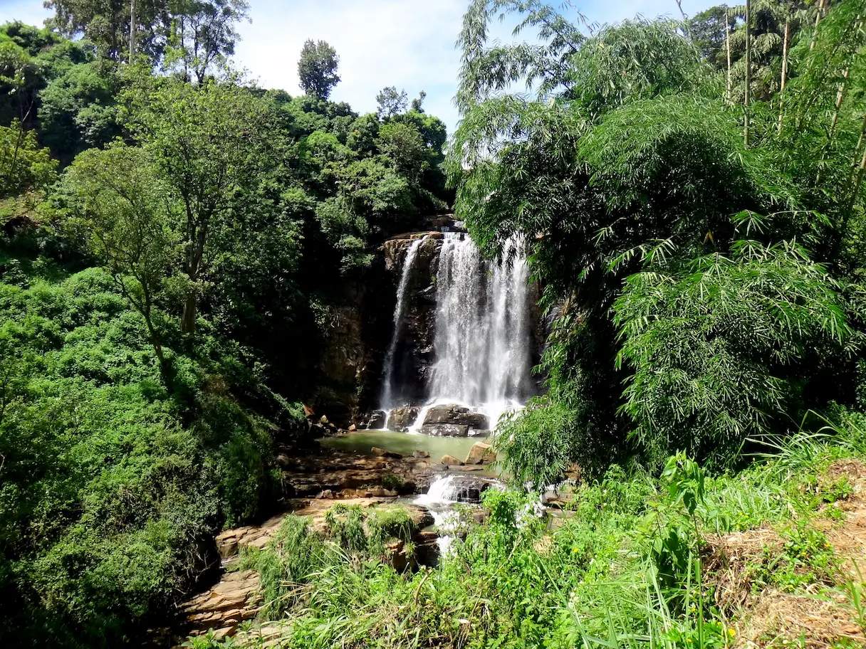
Kadiyallena Falls
A massive staircase-like fall where the water "bounces" down the mountain. Each tier is broad and shallow, creating pools of high-energy white water against dark, polished basalt.
- Type: Wide Tiered Staircase
- Explorer Rating: ⭐⭐⭐⭐ (High tactical energy; great for "silky" shots)
- Best Photo Spot: 50 meters past the bridge on the road bend for the full zig-zagging profile.
- Time Spent: 45 minutes.
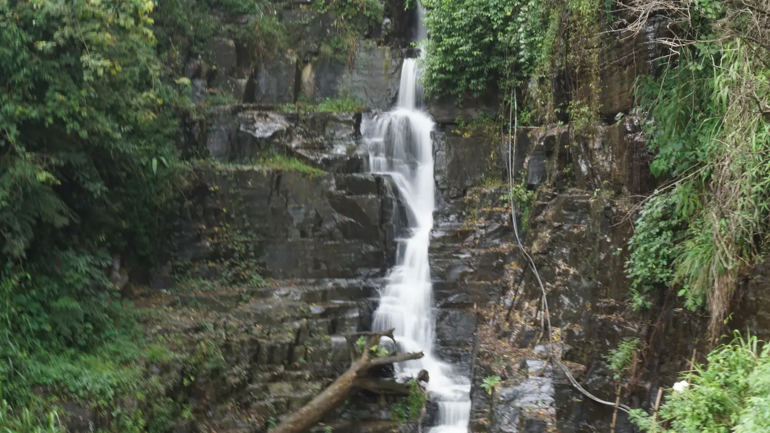
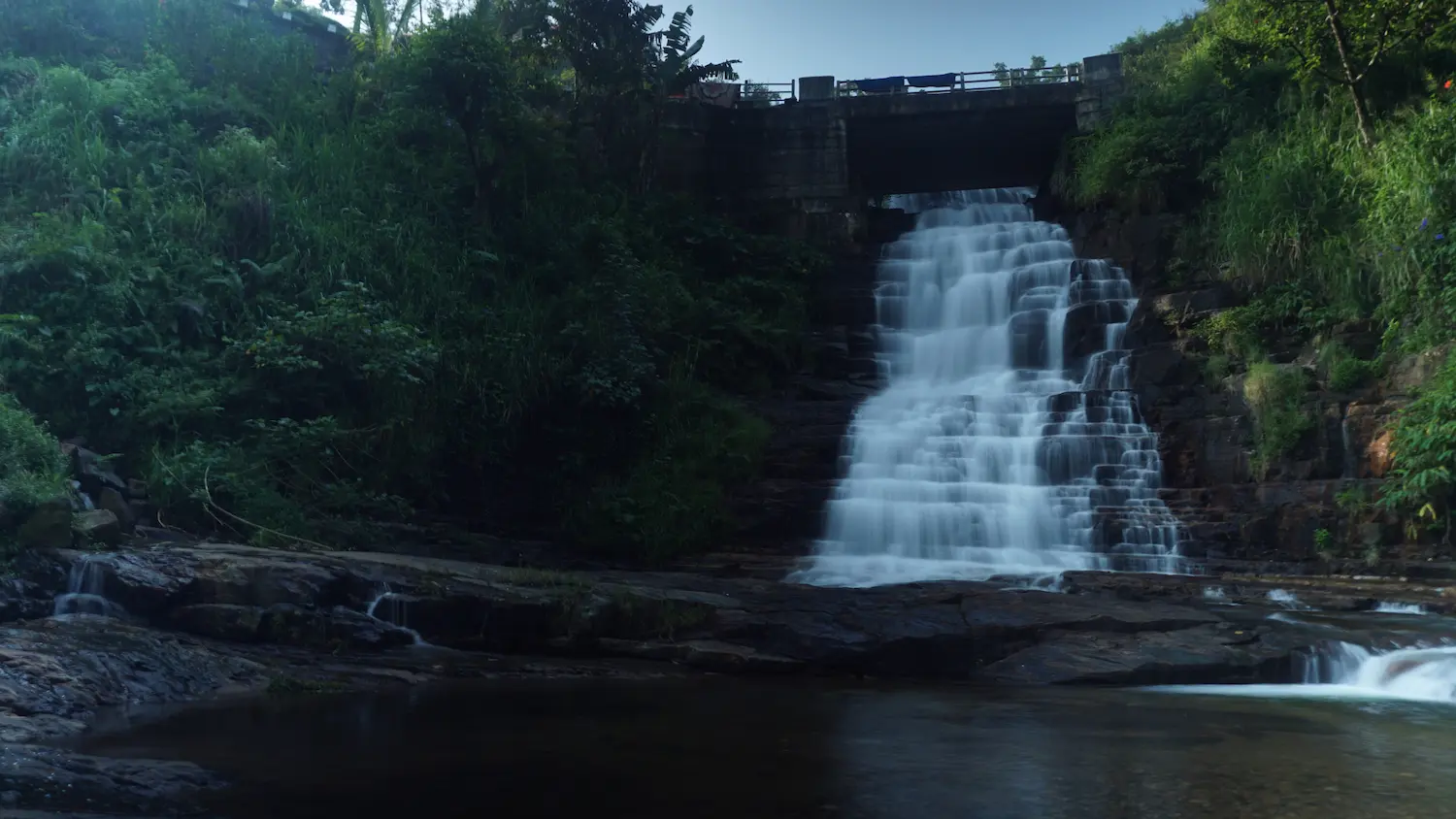
Dunsinane Falls (Upper)
The road aggressively bisects this 100-meter giant. Standing on the bridge, you are caught between a vertical wall of water and an immediate abyss. The spray is constant and the sound is a chaotic roar.
- Type: Giant Tiered Fall
- Explorer Rating: ⭐⭐⭐⭐ ⭐(The most dramatic roadside encounter)
- Best Photo Spot: Center of the bridge, aiming upward to capture the water breaking over the top ledge.
- Time Spent: 20 minutes.
Dunsinane Falls (Lower)
This is the massive, hidden half of the Dunsinane system. While the upper section grabs all the attention at road level, most travelers completely miss the lower part because it plunges directly into the abyss beneath the bridge. It is a raw, intimidating 100-meter drop that marks the definitive edge of the highland plateau. To see it, you must leave the comfort of the asphalt and walk a short distance toward the Pundalu Oya side from the bridge. Look for a narrow, steep footpath leading downhill; this trail takes you toward the base where you can truly witness the sheer scale of the water wall.
- Type: Massive Plunge
- Explorer Rating: ⭐⭐⭐⭐ (Dizzying scale and raw power)
- Best Photo Spot: The steep footpath toward Pundalu Oya for a perspective that captures the verticality of the abyss.
- Time Spent: 40 minutes.
- Access Tip: Do not settle for the bridge view. The downward trek is where the real "Logbook" shot is found. Be warned: the path is often slippery and leeches are common here—wear proper boots and keep moving.
The Logbook Gallery (Photo Coordinates)
- The Ramboda Vortex (Upper Ramboda)
- The Shot: Low-angle wide (16mm).
- The Note: Use a slow shutter (1/2 sec) to turn the "shrapnel" into silk.
- The Iron & Water Contrast (Nanu Oya)
- The Shot: Arched bridge frame with the Blue Train.
- The Note: Rigid iron vs. fluid water—the ultimate highland contrast.
- The Niagara of the East (St. Clair's)
- The Shot: Side-profile pano.
- The Note: Use a polarizer to cut the glare on the wide rock shelf.
- The Lace of Bomuru Ella (Bomuru Ella)
- The Shot: 0.5-second exposure.
- The Note: The "Sweet Spot" timing makes or breaks this shot.
- The Dunsinane Abyss (Lower Dunsinane)
- The Shot: Downward vertical.
- The Note: Include a human element to communicate the 100m drop.