Timing the Rock: A 24-Hour Strategy for Sigiriya
Stop treating Sigiriya as a checkbox. Orchestrate a 24-hour cycle of traditional mud house lunches, Land Master trails, and sunset kayaking. This is the explorer’s logic for the 8th Wonder


The Explorer’s Logic: Most travelers treat Sigiriya as a checkbox. They arrive in a van, climb the stairs in the midday heat, and leave. After 15 years of exploring this landscape, I’ve realized that the "8th Wonder" is only half the story.
To truly see this place, you have to orchestrate your time. This isn't just about a mountain anymore—it’s about the village kitchen, the silent lakes, and the occasional wild elephant appearing at the treeline. This is my record of how to time 24 hours in Sigiriya—focusing on the total experience rather than just the climb.
Logbook Technical Summary
| Entry Detail | Field Note |
| 📍 Location | Sigiriya, Pidurangala |
| ⏰ Optimal Window | 12:00 PM (Day 1) to 10:00 AM (Day 2) |
| 🏔️ Difficulty | Level 3 (Boulder scrambling at Pidurangala) |
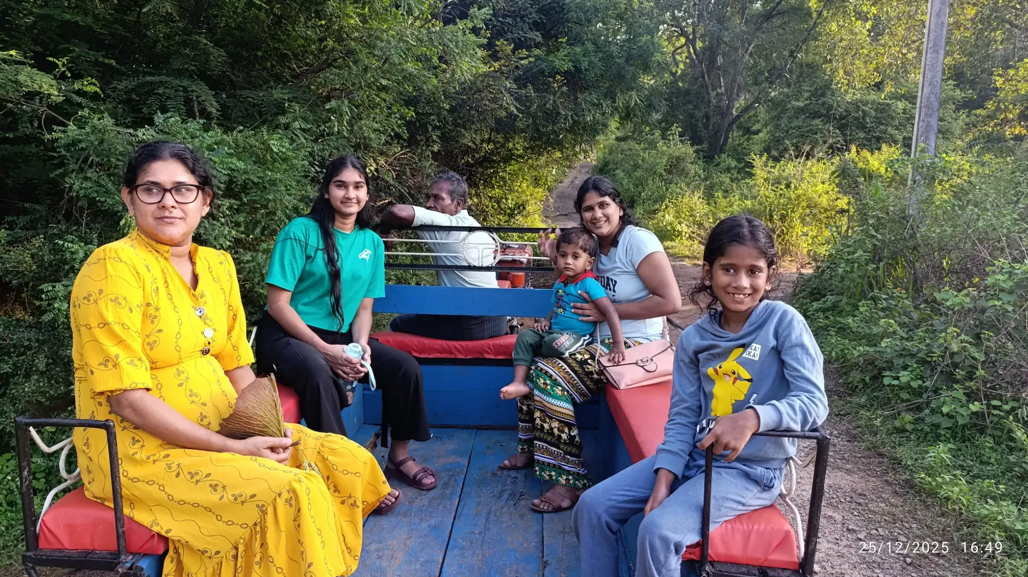
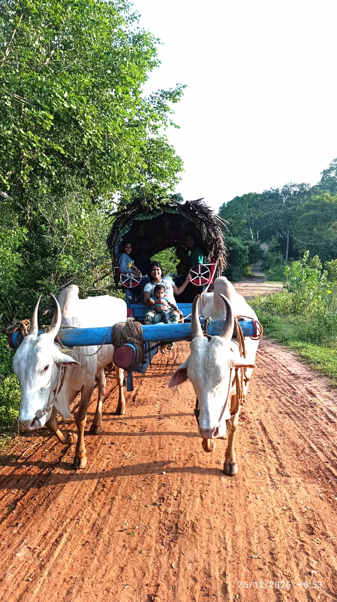
| 👨👩👧👦 Family Note | Excellent. Land Master & Bullock Carts are highlights for kids. |
| 🚜 Access Mode | Southern Entrance for speed; Tuk-Tuk/Land Master for Village. |
| 🏨 Accommodation | Stay within 5km of the rock to ensure a 5:00 AM start. |
Historical Field Notes: The Sovereignty and the Sanctuary
Sigiriya: Built by King Kashyapa (477–495 AD), this was a masterpiece of 5th-century urban planning. It was a royal palace, a fortress, and a statement of power, featuring advanced hydraulics and frescoes that still baffle modern engineers.
Pidurangala: When Kashyapa claimed Sigiriya for his palace, he relocated the Buddhist monks living there to Pidurangala. The name translates to "offered piles of gold," referring to the compensation given to the monastery.
The Adaptive Timeline
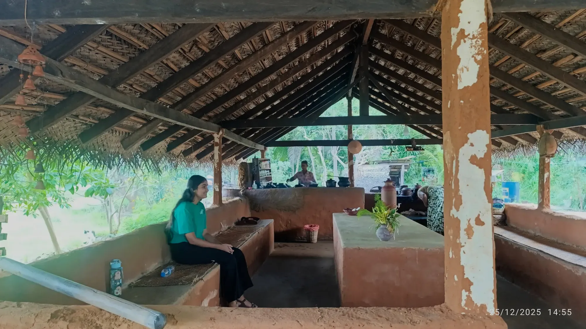
12:00 PM – 2:30 PM – Sigiriya Village Kitchen The scent of burning dry coconut husks dominates the microclimate of the kitchen, settling thick into the wattle-and-daub walls. Eating roasted local grains off a scorched banana leaf over a coarse clay pila (bench) grounds you immediately in the local agrarian rhythm. It is heavy with equatorial humidity and the crackle of the hearth, stripping away the sterile air-conditioning of your transit vehicle.
- Type: Vernacular Architecture / Culinary Immersion
- Best Photo Spot: Position yourself low near the hearth entrance to capture the high-contrast particulate matter moving through the light rays.
- Time Spent: 2.5 Hours
- The Reality Check: The woodsmoke in these enclosed mud structures is dense; step out to the perimeter if your eyes begin to stream.
- The Logic: At solar noon, the UV index on the exposed rock faces is punishing. Retreating to the shaded, slow-paced village utilizes the harshest thermal window for recovery and acclimatization.
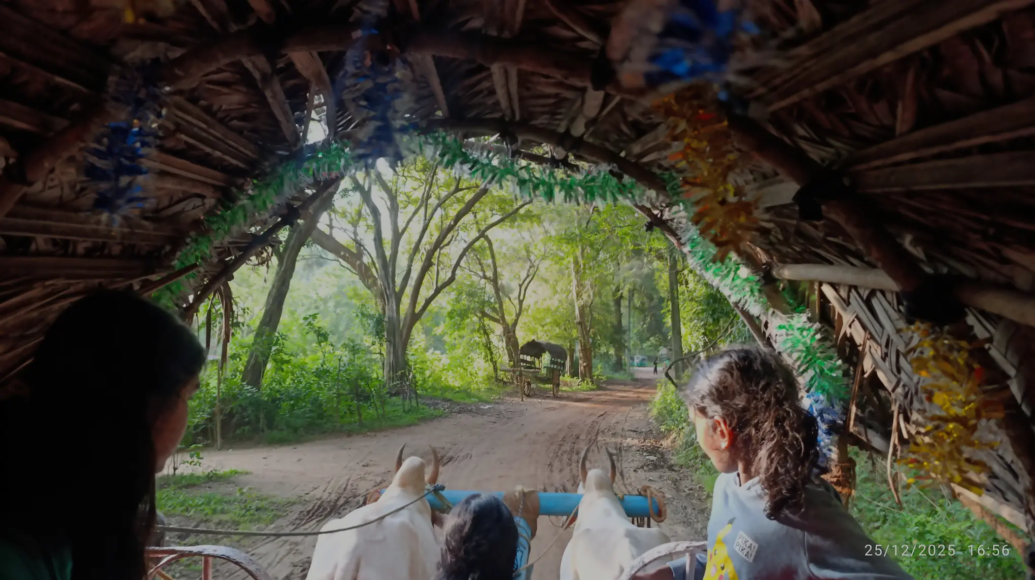
2:30 PM – 4:30 PM – The Dust and Bund Trails
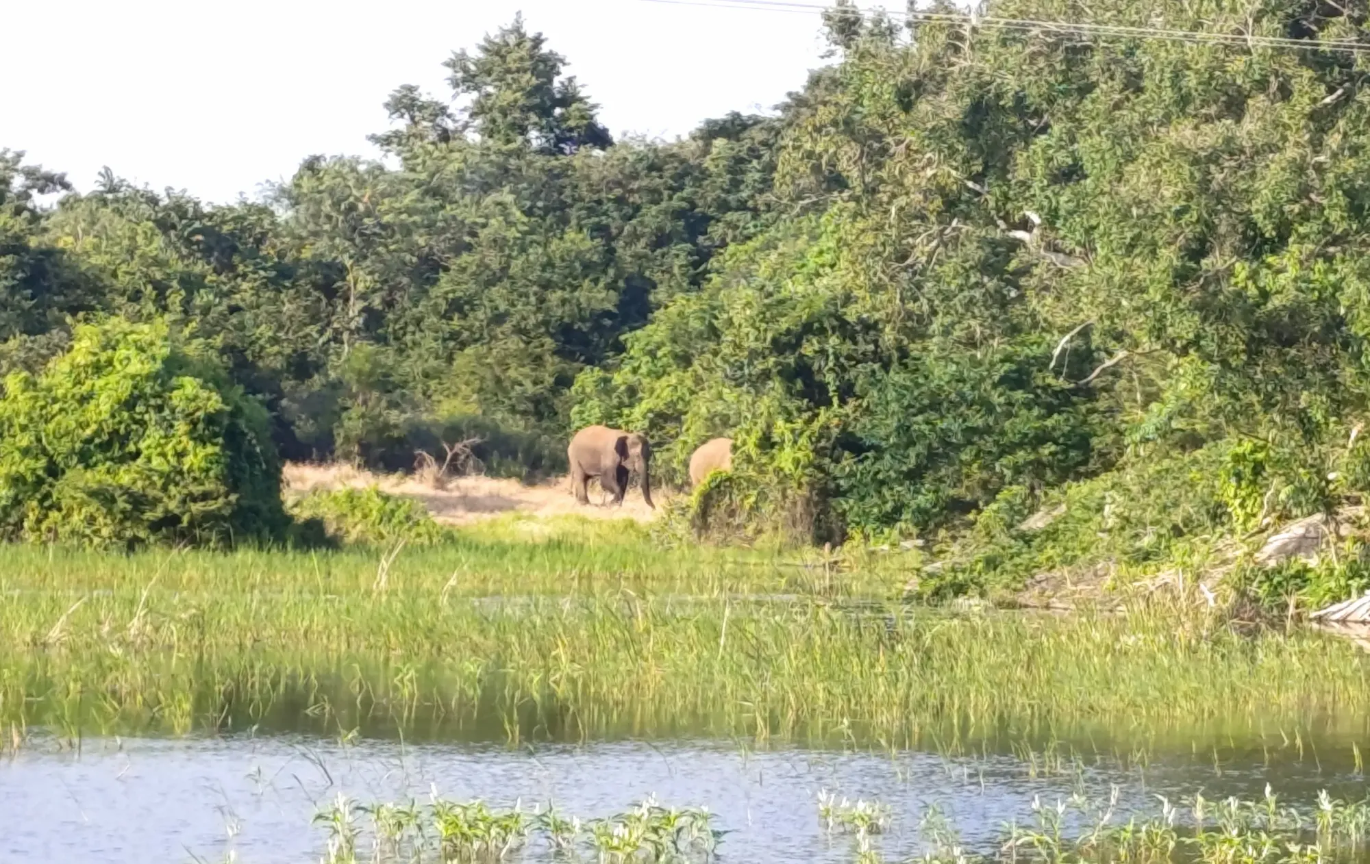
The heat breaks slightly, giving way to a warm, thick breeze across the dry zone scrub. You trade a sealed, air-conditioned vehicle for the raw vibration of a Land Master hand-tractor and a wooden bullock cart. You feel every rut in the red dirt track in your teeth, moving at a walking pace that forces your eyes to track the shifting tree lines instead of a screen.
- Type: Agricultural Transit / Rural Perimeter
- Best Photo Spot: Frame the cart wheels kicking up dry red dust against the dense green scrub foliage from a trailing position.
- Time Spent: 2 hours.
- The Reality Check: This is spine-rattling transport. Secure your gear firmly—anything loose will bounce off the wooden floorboards directly into the dirt.
- The Logic: Slow transport forces environmental acclimatization. It drops your baseline pace and tunes your ears to the dry zone scrub. While moving quietly along the perimeter theoretically improves your odds of spotting wild elephants moving toward the water, let’s be entirely realistic: it happens rarely. Consider an elephant sighting here a stroke of pure luck, not a scheduled event. The actual tactical win of the cart ride is escaping the vehicle exhaust, feeling the topography of the dirt tracks, and syncing with the village timeline.
The ultimate lesson in slow travel
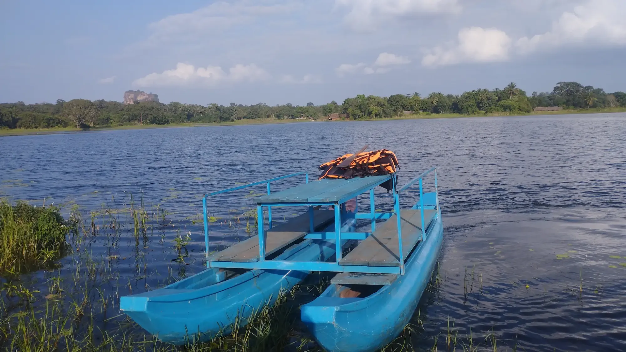
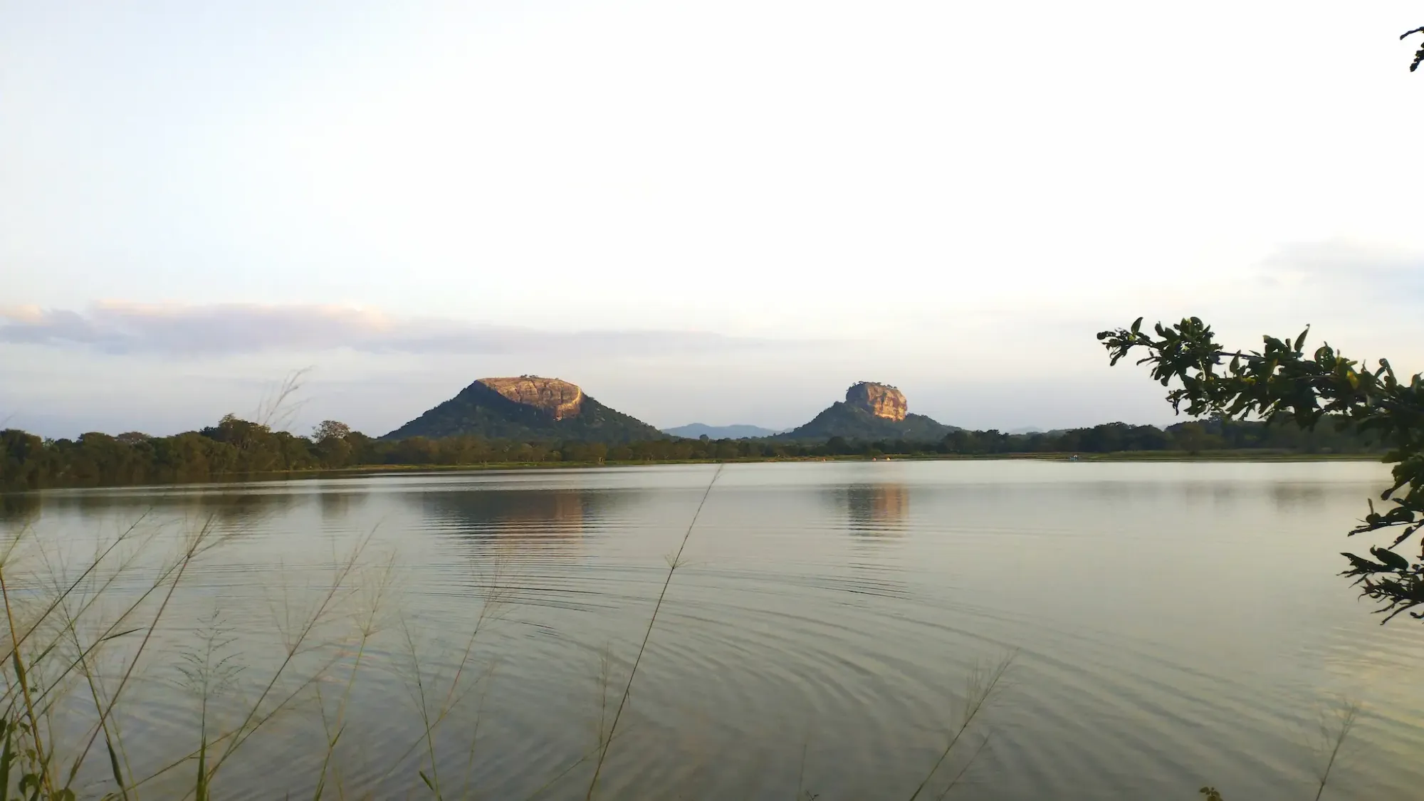
5:00 PM – Sunset – Thalkote Lake (Bund & Boat Transit)
The wind drops entirely, turning the massive reservoir into a dark, flat mirror. The air smells damp, thick with lake weed and cooling mud. Pushing off the muddy bank in a local outrigger canoe or a low-slung kayak changes the perspective completely—you are no longer just looking at the water; you are floating right in the middle of the evening thermal shift. As the sun dips, the harsh overhead glare softens into a deep, directional orange that illuminates the western rock faces, pulling deep shadows out of the granite while your paddle quietly cuts the surface tension.
- Type: Reservoir / Aquatic Transit / Topographical Viewpoint
- Best Photo Spot: Shoot wide from the center of the lake in a kayak or boat. Keep your lens low to the water line to maximize the mirror reflection of the twin peaks on the surface, entirely cutting out the shoreline.
- Time Spent: 1.5 hours (arrive exactly 45 mins pre-sunset to secure a boat and paddle out to the center).
- The Reality Check: Local outrigger canoes (oruwa) and light kayaks can be highly responsive to sudden weight shifts. If you're shooting from the water, keep your camera gear in a dry bag until the boat is dead stationary. If you prefer to shoot from solid ground, the bund is perfectly stable—just pack a standard bug spray for the dusk transition and pack up your gear before true dark sets in.
- The Logic: This specific topographical depression is the exact coordinate where the sightlines of both monoliths align. The tactical choice is yours: stay planted on the earthen bund if you need a rock-solid base for a tripod and long exposures, or take a kayak/boat out to strip away the foreground reeds and sit right in the acoustic silence of the reservoir. Both yield the double silhouette; it just depends on whether you prioritize a stable camera rig or total immersion in the water.
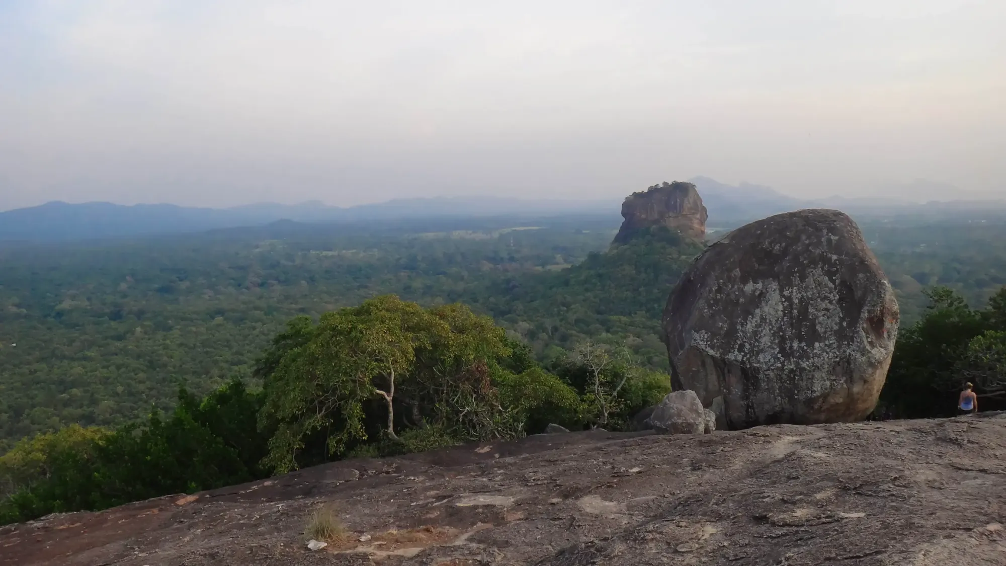
5:00 AM – 7:30 AM – The Pidurangala Scramble
You start in total darkness, navigating the steep, uneven stone steps entirely by the beam of a headlamp. The air is surprisingly cool and smells heavily of damp stone and decaying leaves. The final push strips away any illusion of a walking path—you are hoisting your own body weight over massive, slick granite boulders to break through the tree canopy just as the sky turns a deep indigo.
- Type: Granite Monolith / Scramble
- Best Photo Spot: The flat, eastern-facing rock shelf just below the absolute summit, aiming your lens west as the first light strikes the lion rock.
- Time Spent: 2.5 hours.
- The Reality Check: Do not walk the road to the trailhead in the dark. This is an active, unlit elephant corridor. Hire a local tuk-tuk the night before to drop you directly at the temple gate.
- The Logic: Hitting the summit at dawn means climbing in 22°C (71°F) weather instead of 32°C (90°F), and catching the horizontal sunrise illumination directly hitting the face of Sigiriya opposite your position.

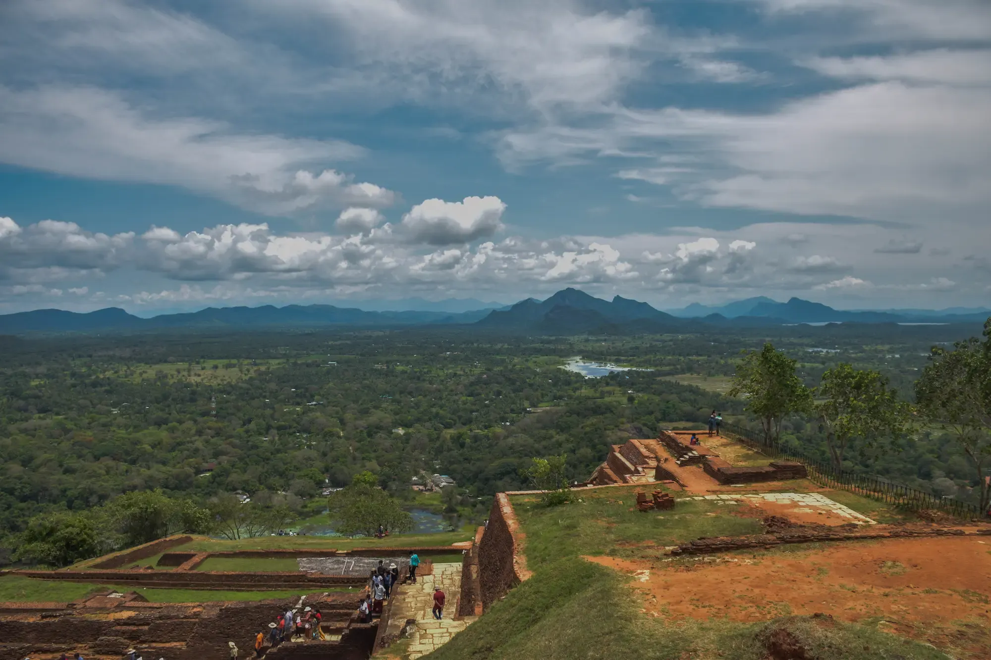
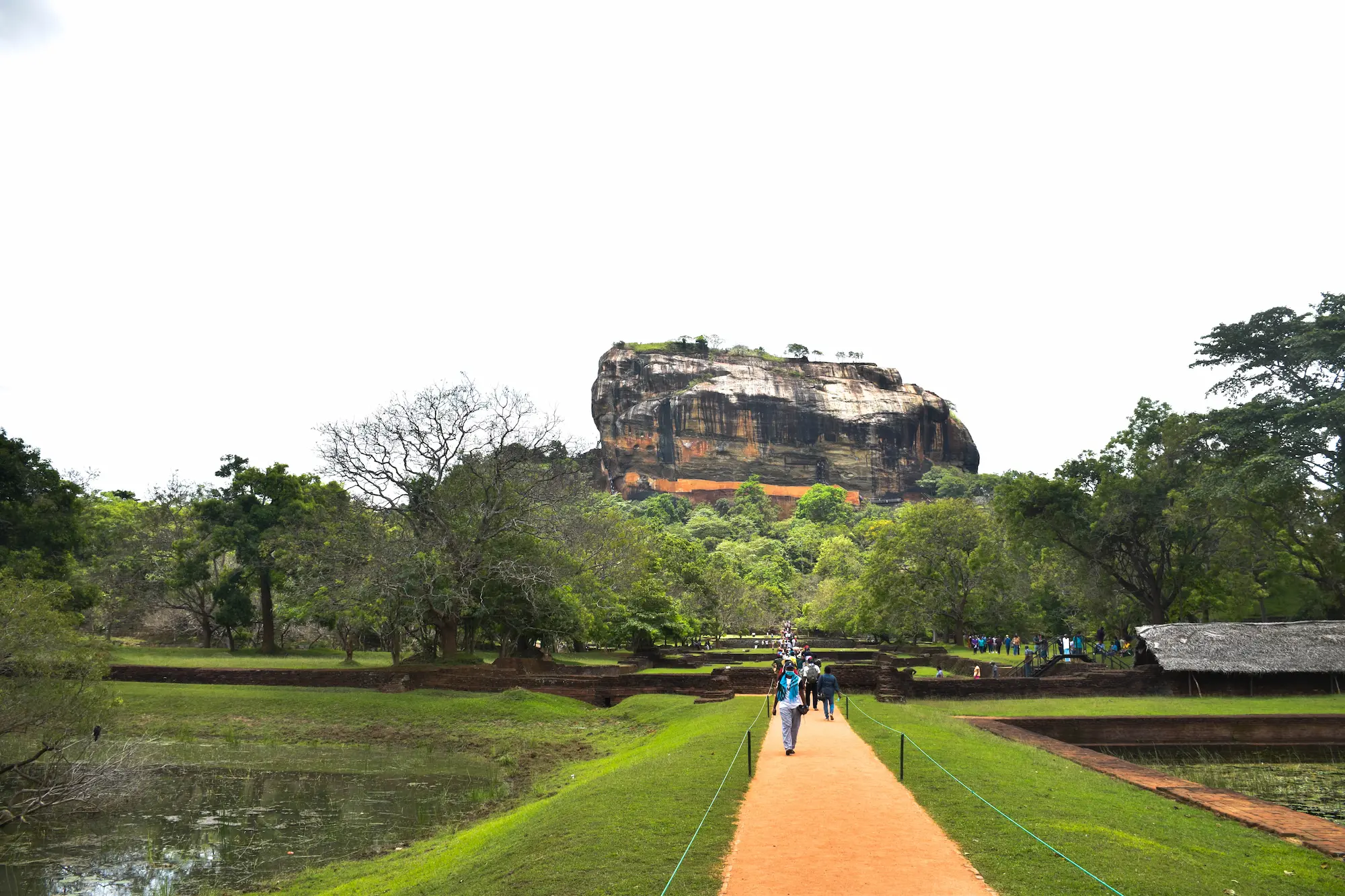
7:30 AM – 10:00 AM – The Sigiriya Ascent (Western Gate)
The morning mist burns off quickly, revealing the massive scale of the brick and terra-cotta ruins. You hear the faint trickling of water through the ancient limestone conduits before you even see the pools. The ascent up the sheer rock face via metal grating is highly exposed and windy, with the heat already beginning to bake the surrounding jungle floor far below.
- Type: Ancient Fortress / Hydraulic Infrastructure
- Best Photo Spot: The central axial walkway in the Western Water Gardens, shooting straight down the symmetrical pools toward the main rock face.
- Time Spent: 2.5 hours.
- The Reality Check: The macaque monkeys here are opportunistic and aggressive. Keep all food, water bottles, and loose items zipped securely inside your bag. They will take it straight from your hands.
- The Logic: Getting through the main gates before 8:00 AM puts you ahead of the tour bus wave. You get the critical structural photographs clean, and you clear the exposed metal stairways before the mid-morning heat makes the steel uncomfortable to touch.
The Access Strategy
- The Southern Entrance (Efficiency): Use this gate if you want to reach the base of the rock faster. It is less crowded and allows you to start the climb while the rock’s own massive shadow still hides you from the morning sun.
- The Western Gate (The Experience): This is the main entrance and the only way to witness the sheer engineering genius of the 5th-century planners.
The Engineering Marvel: The Water Gardens
- Hydraulic Mastery: The gardens feature a sophisticated series of symmetrical pools and underground clay pipes.
- Natural Fountains: During the rainy season, look for the small circular limestone plates with holes. These are gravity-fed fountains that still work today, over 1,500 years after they were built, using nothing but natural water pressure from the surrounding hills.
The Logbook Gallery: Strategic Photo Coordinates
To get the most out of your archive, these are the five precise moments where geography, engineering, and light align.
1. The Symmetry Shot (Western Water Gardens)
- The Shot: Stand in the center of the main axial walkway between the two largest symmetrical water gardens. This is the most popular vantage point for capturing the sheer scale of the 5th-century fortress rising behind the ruins.
- The Timing: 7:30 AM – 8:00 AM. Arriving early allows you to use the low, soft morning light to illuminate the rock’s texture without harsh shadows or the heavy crowds that arrive later in the morning.
2. The Double Silhouette (Center of Thalkote Lake)
- The Shot: Use a wide-angle lens from a boat or kayak in the center of the lake.
- The Timing: 20 minutes before sunset. As the sky turns orange, the water becomes a mirror, allowing you to capture both Sigiriya and Pidurangala in a single, balanced frame—a perspective most land-based travelers miss.

3. The Golden Face (Summit of Pidurangala)
- The Shot: Look West toward the Lion Rock from the flatter area of the Pidurangala summit.
- Sunrise (6:05 AM): For the "Golden Face" detail and clear visibility of the ruins.
- Sunset (6:00 PM): For the dramatic "Silhouette" and the colorful sky over the horizon.
4. The Village Motion (On the Bullock Cart)
- The Shot: A low-angle "GoPro" style shot or a wide-angle lens from the rear of the cart.
- The Timing: 3:00-6.00 PM. The afternoon light is harsh enough to highlight the dust kicked up by the wooden wheels, creating a raw, "National Geographic" style texture that emphasizes the slow pace of village life.